Wednesday, January 13, 2010

A warm glow in a wintery Loch Long


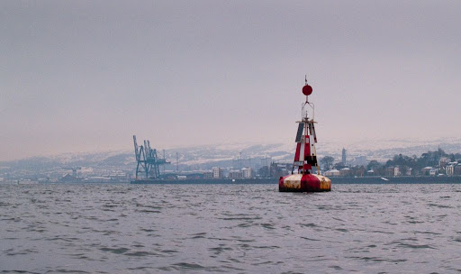
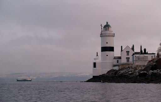
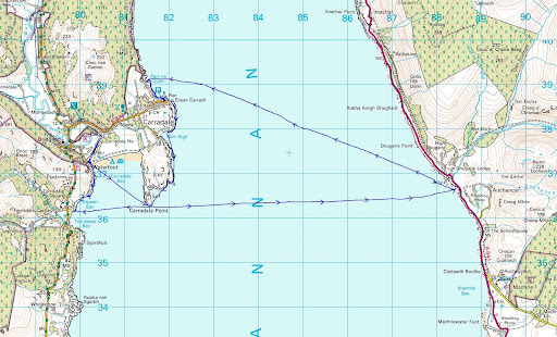
From Kilcreggan on the Rosneath peninsula we proceeded west to Baron's Point. Here we turned to the north and entered Loch Long. Loch Long is indeed long it stretches north from here, in a narrow fjord like ribbon, for 26km. For most of its length it is between about 50m and 95m deep. Its head at Arrochar is 130km from the mouth of the Firth of Clyde. All the lochs at the head of the Firth have been gouged out by glaciers during the Ice Age.


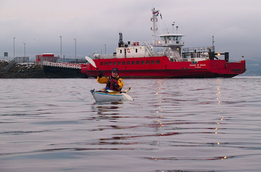
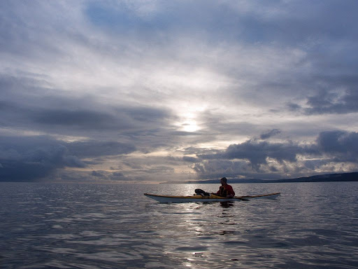
Just turning a corner revealed mountain scenery, which was a complete contrast to the industrial landscape we had just left. Low, snow carrying clouds hung over the mountains and flurries of snow threatened to turn into a full snow storm at any moment. It was very cold.


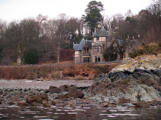
Past the delightful village of Cove, we came to the 4* Knockderry House Hotel. This hotel is sea kayak friendly and is a regular haunt of Pam and her friends. The hotel staff seemed to be expecting us because, on our approach, a piper emerged onto the snow covered grounds of the hotel and started to play the first of several tunes. The skirl of the pipes echoing round the snow covered mountains was a truly magnificent experience, to which we added a dram of single malt Scotch whisky...


Unfortunately we had no time to partake of luncheon and refreshments in this lovely establishment's hallowed halls or comfort ourselves next to the warm glow of its fire. The sun was already dipping to the horizon. So after a quick flask of soup, washed down with a 12 year old GlenLivet, a Bruichladdich 3D and a 10 year old Springbank, we continued on our way.


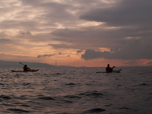
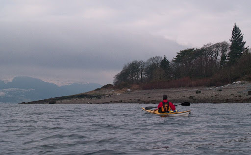
Refreshed but frozen, despite the warm glow in both our stomachs and the sky, we crossed to the far side of Loch Long.


Our destination was Strone Point behind which lay the Holy Loch.

Tuesday, January 12, 2010

Little and Large on the Clyde: Ocean terminal and Kilcreggan pier


Arriving at Greenock we turned south into the little bay behind Whiteforeland Point. This is the beach that the Royal West of Scotland Amateur Boat Club launch from. They have sailing, rowing and canoe sections. Kayaks (decked canoes) have been paddled and sailed on the Clyde since the mid to late 1800's but traditionally they have been called canoes.

The large brick structure behind is called the Navy Buildings and houses the Clyde Maritime Rescue Co-Ordination Centre or Clyde Coastguard for short. It was built on the site of Fort Matilda, a defensive gun battery, which was completed in 1819.


Under the watchful eye of the coastguard we decided to cross the shipping lanes by hopping from buoy to buoy at right angles to the lanes. The first buoy was the Whiteforeland mid channel marker.


The wreck, just to the SE of the buoy is that of the Iona I, a paddle steamer that had been nick named the "Queen of the Clyde" because of her speed. She was built in Glasgow in 1855 but sank here after colliding with another ship in 1862. She was on her way across the Atlantic to run goods to the Confederate States through the Union Naval blockade* in the American Civil War.


We looked back to the cranes of Greenock's huge Ocean Terminal which is a sheltered deep water port and is the main container port for Scotland and the north of England. It is also visited by an increasing number of cruise liners evern the huge Queen Mary 2. Not so long ago the skyline would have been a forest of cranes working the shipyards and the docks. Now most have gone, though the 250 ton Titan crane at the James Watt dock can just be seen in the background. There are still 4 Titan cranes standing on the Clyde. The others are at John Brown's shipyard, Clydebank, Barclay Curle & Co, Glasgow and the Finneston crane, Stobcross Quay, Glasgow.


On crossing the Clyde we found ourselves at the Rosneath peninsula which divides Loch Long and the Gare Loch. Kilcreggan is its main town and this is the pier backed by a line of elegant Victorian mansions. A sign at the end of the pier says no cycling... The pier is the last Victorian pier left on the Clyde. The town grew up from the 1820's onwards when the steamers allowed wealthy business people in Greenock and Glasgow to escape the industrial smog and build fine Victorian mansion houses along the coast. Frequent steamers allowed them to commute to the city for work.

*see comments.

Monday, January 11, 2010

Keeping an eye open for ferries at Gourock


As we approached Gourock, we came to McInroy's Point, which is the terminus for the Western Ferries route to Hunter's Quay on the Cowal peninsula. This is the MV Sound of Shuna and she has three sister ships: MV Sound of Scarba, MV Sound of Sanda and MV Sound of Scalpay. If you plan to use this crossing you can get discount tickets in Paul's Food and Wine shop at 94, Shore St, Gourock.

These ferries operate a very quick turn around so we stopped where the captain could see us. He came out onto the flying bridge and waved us on. We got a good boost from the ferry's thrusters, which were holding her at the jetty.


We cruised past Gourock esplanade enjoying views over the Firth of Clyde to the Cowal Hills and the Holy Loch.


We turned south round Kempock Point. We passed under the once grand Gourock railway terminus which once transferred thousands of Glaswegians to steamers to take them "doon the watter" to the Clyde resorts where they spent their holidays.


We found two CalMac ferries "resting" between assignments. MV Jupiter normally covers the Gourock to Dunoon route but her sister ship MV Saturn is covering that service at the moment. In the summer Saturn provides extra crossings from Ardrossan to Brodick. I last saw MV Loch Alaine on the Eriskay Barra route.


As we left Gourock MV Saturn was approaching her berth. We could just make out the MV Seabus, leaving Kilcreggan bound for Gourock. She is a passenger ferry operated by Clyde Marine Sevices on the Gourock Kilcreggan Helensburgh route.

It sounds like Gourock is a busy ferry terminal. Well it is, but it is a shadow of its former self. Scores of competing ferries raced each other to the piers that had sprung up all round the Clyde. A sea kayaker would have needed very sharp eyes in those days. Even today, we chose to cross the various ferry routes near their piers and jetties.

Sunday, January 10, 2010

Two iconic, but ultimately impotent, towers on the Clyde


The overnight temperature had gone down to -17C and when I left home it was -10C. It was also snowing and a fresh fall of 4cm lay on top of the snow that has been on the ground since before Christmas. With my bad knee, I have been virtually housebound as I can't walk on the iced pavements. It was with some anticipation that I arranged to go sea kayaking with Jim and Phil. In view of the snow we arranged to paddle locally and met at Lunderston Bay on the Upper Clyde.


It was a bit of a surprise to find snow on the beach but it was soft and fresh and not hard and icy. Nonetheless, Phil and Jim carried all the kayaks to the water's edge, leaving me in charge of photographic duties. In the distance is the chimney of the disused Inverkip oil fired power station which was built in 1970. It is 236m high and is the tallest man made structure in Scotland. Currently there are plans to demolish it to build 800 houses on the site. It was built at the time of the first World oil crisis and was mothballed except for a brief time during the coal miners' strike of 1984/85.


Once on the water we soon passed Cloch lighthouse in the pink light of dawn. This was built in 1797 by James Clarkson with Thomas Smith and Robert Stevenson supplying the lantern and lens mechanism. The present owner of one of the converted lighthouse cottages waved from his conservatory. What a view he must enjoy!


Sadly the magnificent lantern mechanism is no longer in use. It has been replaced by an iron pole with what looks like a 60 watt bulb on top. It still flashes white, once every 3 seconds but as we were to find later, it can hardly be seen from Dunoon, less than 3km away.

Friday, January 08, 2010

Return to Dougarie


It had started to snow with a northerly wind as we set off across the Kilbrannan Sound on our return to Arran. By the time we were halfway across the snow stopped and the wind dropped.


The latter half of our crossing was most pleasant and we were soon approaching the Arran shore. In the Kilbrannan Sound the north going flood starts 5 hrs before HW Dover and the south going ebb starts at HW Dover. HW Dover was at 1324 and we were approaching the shore at 1425. Although the tidal stream atlas shows a max ebb rate of 0.4 knots at springs, there was a much stronger current just offshore. At one hour after HW slack, I measured 1 knot of ebb current, about 250m offshore. Something to bear in mind if you are paddling round the west coast of Arran.

The recently restored boathouse and slipway of Dougarie Estate came into view with Dougarie Lodge behind. The Lodge was built as a summer house in 1865 by the Duke of Hamilton who owned Brodick Castle on the east of Arran.


My knee was really bad and Phil gallantly carried both boats up the beach. Thank goodness it was not low water. We made it back to Brodick in plenty of time for the ferry and picked up Alan and his kayak at the terminal. He had enjoyed a great day's paddle round Holy Island and he had even seen two otters. So despite a forgotten dry suit we all had a good day out.


We had covered 25km which we thought rather good for a short winter day, two ferry trips and two snowy drives over a mountain road!

Thursday, January 07, 2010

Time to go in the Carradale Water


We left the pines of Torrisdale Bay and paddled north, past a series of skerries, to enter Carradale Bay.


At the west end of the bay we discovered the outflow of the Carradale Water. This is a well known salmon and sea trout river and like them, we felt an urge to head upstream.


It was spring HW and were able to paddle 1km upriver. Our hulls rose onto sheets of ice and then crunched down through them like mini ice breakers. It was now 1300 hours and the Arran ferry would be loading at Brodick at 1620. We still had a 9km crossing of the Kilbrannan Sound and an icy drive over the mountain String Road from the west to the east coast of Arran.

It was time to go!

Wednesday, January 06, 2010

Torrisdale Bay in the Kilbrannan Sound.


So sooner had we turned south from the rusting piles of Carradale than this amazing view opened up; right down the Kilbrannan Sound to Ailsa Craig (44km away) and the distant Ayrshire coast behind.


Carradale Point has the remains of an Iron Age vitrefied fort on its summit. I wonder what its residents would have made of Irn-Bru?


Carradale Point shelters the broad sandy sweep of Carradale Bay.


By now we were ready for a luncheon and we landed on this lovely shingle beach at the foot of the mountains and backed by a Caledonian pine forest.


From Torrisdale Bay we looked out onto the mountains of Arran...


... and Ailsa Craig while we enjoyed our simple fare finished off with Christmas cake and 18 year old Glenfiddich.