Saturday, April 12, 2008

Wreck of the Schooner Monreith


There are no harbours accessible at all states of the tide on the whole stretch of the Scottish Solway coast from Gretna in the East to the Mull of Galloway in the west. Following the many indentations of the coast, this is a distance of over 270km. Danger to ships is confounded by the large tidal range of nearly 10m at springs and the extensive sand and mud banks which are exposed at low tide. The whole coast is exposed to southerly winds and swells and if ships were caught out by a storm at low tide they had to try and find shelter at the entrances to the firths. Only when the tide was high could they make their way up the river channels to the shelter of the wharves in such towns as Kirkcudbright.


On the 12th November 1900, the two masted sailing schooner Monreith, from the Galloway port of Wigton, was carrying a load of granite kerb stones from Newcastle in County Down, Northern Ireland to Silloth in England. A storm blew up and she attempted to take shelter in the mouth of Kirkudbright Bay (behind Little Ross Island, the island with the lighthouse on the horizon.) The bay was not yet deep enough and grounded and was driven onto the sand banks of Goat Well Bay where her timbers were pounded by the surf until she sank. Her crew were able to launch a boat in her lee and made their way safely ashore just as the Kirkcudbright lifeboat arrived. Monreith's sturdy timbers can still be seen reflecting in the wet sands at low tide.

22/03/2008


If you launch or land at Dhoon Bay near high water, you will miss this part of the Bay's history.

Goat Well Bay, Nun Mill Bay and Dhoon Bay are pretty much synonymous. Although not used on the map, Dhoon Bay is the current local name.

29/09/2007

Friday, April 11, 2008

Kircudbright slipway


Downstream of the Kirkcudbright fishing fleet moorings, there is a small slipway which gives access to the tidal River Dee. It is very near the main public car park in Kirkcudbright and if you launch here shortly before high tide, you can explore the upper tidal reaches of the Dee to Tongland. You can then follow the ebb out to Dhoon shore and pick up a shuttle car there. Once a spring ebb starts to run it belts along about 9 knots so you want to get the timing right. Alternatively you can continue out of Kirkcudbright Bay, through the tidal races of Little Ross Sound and paddle round to Brighouse Bay.

The attractive harbour cottage was due to be demolished in 1957 but was reprieved and converted into a gallery.

22/03/2008

Thursday, April 10, 2008

The fishermen of Kirkcudbright Harbour


The fishing fleet is in, bringing colour to Kirkcudbright Harbour.

Like Maidens, Kirkcudbright's fishing fleet declined during the first half of the 20th century. Then in the late 1950's a revival started after local man, John King, started lobster and scallop fishing. Gradually the number and size of the boats increased and construction changed from wood to steel. Today there is only one traditional wooden Scottish boat left. She is the "Fredwood" on the extreme right of the photograph. Most of the boats are scallop dredgers but "Argo", the small boat in the foreground, is a cockle dredger. One of the biggest boats is the blue boat, third from the right. She is the "King Explorer" and is part of the John King fleet.

A local economy has built round the fishing fleet; fish processing, dredging gear manufacturers, suppliers etc.. Local restaurants serve fresh scallops which make an excellent starter before a succulent grass fed Galloway fillet steak.


All this has come at a cost, in 1985 the "Mhari-L" was lost with all 5 hands. Then in 2000 the "Solway Harvester" was lost with all 7 hands. Both vessels were lost in the Irish sea between Galloway and the Isle of Man. On their way to the boats, fishermen walk past a memorial dedicated to the women and children of this and other Galloway fishing communities who have lost their menfolk.

22/03/2008

Wednesday, April 09, 2008

Maidens Harbour


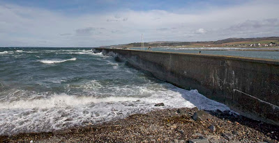
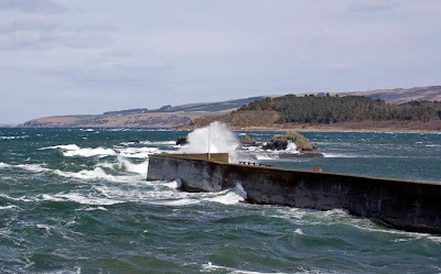
Maidens Harbour wall was originally built to allow commericial fishing boats to remain at mooring rather than be dragged up out of the water onto the foreshore.


It does a really good job of protecting the enclosed harbour on what is a relatively exposed piece of coast.


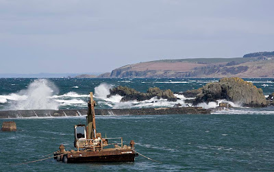
Behind the wall the sea remains calm but over the years the harbour has silted up with sand.


The harbour has been taken over by the Maidens Community Harbour Trust. With the aid of a local authority grant, they bought a dredging barge and a dump truck. Volunteers are dredging the harbour but this time for recreational use.

O6/04/2008

Monday, April 07, 2008

A rest day on the Clyde.


As we drove south along the road above the cliffs south of Ayr the snow clouds that had gathered round parts of central Scotland cleared leaving a beautiful sunny afternoon. From a height of 125 meters, the sea below Balchriston Farm and Culzean Castle looked quite flat. Nontheless it looked a bit breezy for a crossing to Ailsa Craig! On the way south we had followed a 4x4 with 2 sea kayaks on the roof. It turned down the road to Dunure. Not an easy launch at high spring tide, I thought.


When we got to Maidens launching looked slightly problematical.


The cold north wind had generated some surprising waves, even in the confines of the Firth of Clyde. Surprisingly the hills of Arran had escaped the morning snowstorm which had hit Glasgow.


Even the sea birds were resting. I realized why I had left the kayaks at home.

06/04/2008

Sunday, April 06, 2008

A maritime climate


Scotland has a maritime climate. Although it stretches from 54 degrees North at the Mull of Galloway in the SW to 60 degrees North at Muckle Flugga in Shetland in the NE, we do not get a great deal of snow. This is because the prevailing wind comes from the SW as does the warm sea current, the Gulf stream. Otherwise we would be frozen solid in winter and not enjoy our winter sea kayaking.

However, if the wind swings to the north we get snow, like this morning!


This was the 31st of May in 1978 at Loch Morlich in the Cairngorms. As you would expect from the time of year, children are paddling in the loch. However, the previous weekend the wind had come in from the north and resulted in a huge dump of snow. We skied late that year!

One model of Global warming is that the Gulf stream might switch off, in which case we will be, paradoxically, frozen in winter in a warmer world.

Saturday, April 05, 2008

Sannox sunset


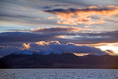
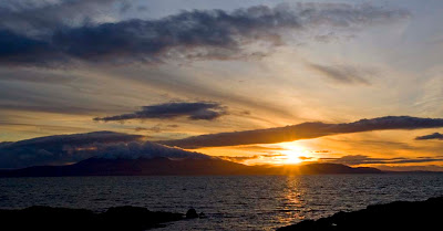
After getting off the ferry at Ardrossan, we returned to our departure point at Portencross as the sun was setting.


The winter sky turned to gold..


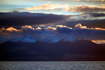
... as it set to the north of the Sannox mountains on Arran.


The setting sun's last rays had left the mountain tops in the gathering cold and darkness of night. But even after the sun had sunk well below the horizon, the tops of high clouds still caught the last of the fleeting winter day.


A perfect winter's day.

18/03/2008