Saturday, December 29, 2007

Melting glaciers, kayaks, interconnectors and ships.


On our journey south along Ayrshire's Atlantic coast, the volcanic cliffs are breached in only one place. The low winter sun played a warming light on Curarrie Port but the air was icy cold. The wooded glen follows the line of a geological fault but the tiny present day Shallochwreck Burn is not big enough to have cut the deep glen. However, at the end of the last ice age, it would have been a raging torrent carrying melt water from the glaciers of Galloway to the sea.


Currarie port is just about the only landing spot in 10km of this rocky coastline. Even so surf often breaks heavily on it and you need to be prepared for a cockpit full of water on launching or landing. I do love the fine lines of the Valley Nordkapp LV hull. I just wish it had a Rockpool cockpit!


Northern Ireland Energy Holdings.
In 2001/02 the construction of the Moyle Interconnector allowed the export of electricity from Scotland to Ireland. The route of the 500MW cables also took advantage of this breach in the cliffs. Fortunately there is no trace of the excavations.


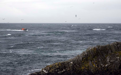
Just offshore from Currarie Port this mystery ship loomed out of the sea mist. Her course was much closer inshore than the normal shipping channel. She was flying no flags to identify her origin. The large crane may be for lifting and lowering a submersible. Perhaps she is a cable inspection vessel?

One way or another, lots of things today are linked to a meting glacier 10,000 years ago!

21/12/2007

P.S. Stuart A. has kindly identified the ship and her role:

"The ship is the MV PHAROS which belongs to the Northern Lighthouse Board. She is used for the maintenance of navigational marks - hence the crane for lifting large buoys, etc. and the reason why she was off the beaten track."

The NLV Pharos came into service in March 2007. She was built in Poland. Her smaller sister ship is the NLV Pole Star. She was commissioned in 2000 and was built by Ferguson's on the Clyde.

Thursday, December 27, 2007

Paddling past pillow lava at Downan Point


As we paddled past Downan Point, on the south Ayrshire coast, we came across ancient lava floes where the cliffs tumbled into the sea.


On closer inspection we found the basalt rocks to be in a form called pillow lava. These pillow lavas date from the Caradoc age of the late Ordovician period, some 450 million years ago. At that time sea levels were much higher than today and these lavas were formed when they oozed from a volcanic vent which was under water. Despite their great age, these pillows look as fresh as any contemporary pillow lavas found on Hawaii.

Wednesday, December 26, 2007

Winter solstice on Ayrshire's Atlantic coast.


Leaving the great beach of Ballantrae, we paddled SW along Ayrshire's Atlantic coast. The volcanic rocks plunge into the swell that comes through the North Channel between Ireland and Scotland.


It is a wild place with few beaches and no road access to the shore. If you are lucky enough to catch it with slight swell there are innumerable caves and channels to explore.


As we made our way down the coast we left the swans, ducks, herons and oystercatchers of Ballantrae behind. We entered the realms of the cormorants and rock doves. Headland after headland disappeared into the hazy thin winter sunshine. Then we came to Dove Cove and a golden eagle swooped into a flock of unsuspecting rock doves as they emerged from a cave.


We paddled as far south as Brackness Hole but by then the winter solstice sun had begun to sink to the horizon and we knew we had to return.

21/12/2007

Monday, December 24, 2007

"A weekend at the races." Ocean Paddler # 6.


Issue six of the renowned sea kayaking organ, Ocean Paddler, carries an article entitled "A weekend at the races." It was composed by myself and carries a selection of photographs like the one above. In it Tony is contemplating on the view from Lunga across Eilean Dubh Mor to the distant mountains of Mull beyond. Rich Parkin and the editorial team chose several accompanying photographs. All depict scenes of calm waters and serenity amongst the islands of Lorn. Regular readers of Ocean Paddler will realize that my articles complement tales of great circumnavigations and crossings that some sea kayakers would rather only read about. My articles are designed to inspire average recreational paddlers to get out and explore their local waters. As a result, the choice of photos in the articles tend to show calm seas and blue skies!

However, these are the pictures that Rich, the editor, would rather you did not see! Do not be fooled by photographs like the above, the Grey Dogs can bite!


The Grey Dogs, two hours into a spring flood tide.


The race extends about two miles out to sea.


A 22m RIB shows the scale of the standing waves.


25/26/08/2007

Sunday, December 23, 2007

Shingle and terns at Ballantrae.


Once we launched from Ballantrae we turned to the SSE and paddled parallel to the great cobble beach which stretches for almost 2km.


The beach is broken only by the mouth of the River Stinchar. We were last here in November 2006 and the river mouth is now 600m further north. This is a very dynamic part of the coast. Just behind the bank of cobbles there are various oxbow lakes and lagoons formed as the river changes course and its mouth is altered by winter storms.

The beach is a Site of Special Scientific (SSSI). In summer it is the nesting ground for countless Little Terns and Arctic Terns. Unfortunately the delicate balance of the beach is being threatened by contractors who are illegally removing hundreds of tons of shingle.

21/12/2007


This is a view from the south end of the beach taken on our last visit on 03/11/2006

Postscript.
You might notice the Ocean Paddler magazine logo on the bow of Tony's boat. It reminds me that the December issue has just been published. Buy it! It is very good.

Saturday, December 22, 2007

Surf's up at the village on the beach.


Yesterday the surf began to roll into the beach at Ballantrae in advance of today's depression. You can tell this is a surf beach, it's very steep and sand and shingle at the low water mark give way to large cobbles at the high water mark. It faces north west through the North Channel between Ireland and Scotland to the open Atlantic beyond.

I am sorry this photo is a bit squint, it was not very easy composing it. The dark brown appearance of the water is due to Galloway peat stained river water. The River Stinchar flows into the sea here.

The village of Ballantrae is built on a raised beach. This raised beach extends for many miles to the north and is broken only by occasional cliffs and headlands. Early cropping Ayrshire potatoes are grown in the fertile soil which is kept mild by the effects of the Gulf Stream.

The name Ballantrae is derived from the Gaelic "Baile an Traigh" or village on the beach. Fishing boats with the registration letters BA (for Ballantrae) are actually based in the shelter of Girvan harbour some 19km away to the NE. Ballantrae's inhabitants favoured farming rather than fishing. That should tell sea kayakers a little about what dumping surf conditions on Ballantrae beach might be like in inclement conditions. Beside the small car park, a simple sign says "Dangerous Bathing". Make sure you practice surf landings before launching at Ballantrae. If the surf gets up while you are out, expect a hard landing or face a long paddle to Lendalfoot which is the nearest sheltered bay, 9km away round Bennane Head and its tidal race.

21/12/2007

Friday, December 21, 2007

Has the sun finally set on a fantastic 2007 paddling year?


Today, on the shortest day of the year, I left the house in darkness and freezing fog at 8am. The temperature was -10.5C . I returned in darkness at 6pm when the temperature was a heady -7C.

Despite the cold, David, Tony and I enjoyed a fantastic paddle, rockhopping along the wild and remote Ayrshire coast which lies to the SW of the huge shingle and cobble beach of Ballantrae.


The temperature dropped like a stone as the sun set.

Maybe this was the final paddle of the year, maybe not! :o)

21/12/2007