Sunday, November 19, 2006

Victim of fashion.


Every so often a really great new bit of kit comes along. Take the Nokia 6250 as an example. It is shock resistant, dust (and sand) resistant, water resistant, big keys for cold fingers, large Lion battery with 14 day standby, automatic volume control that increases or decreases the loudspeaker volume level to cope with background noise (designed for use on building sites but very effective in a howling wind), outstanding transmission and reception, built in sound meter to set the surround sound on the home cinema and it even lets you make phone calls!

It sounds like the ideal sea kayaker's mobile phone. Yes indeed and where may these paragons of maritime functionality be purchased? Well sadly they were last available in the year 2000 and mine is now 6 years old. A victim of the fickle fads of aficionados seeking the latest fashion flavour in phones, it sold like a brick and was discontinued. It is a brick and I look after it. It has an incredible additional effect on anyone under the age of 50. If I produce it in public, which is rare as I find the necessity to call in such places occurs infrequently, it causes much hilarity and occasionaly, some little sympathy among onlookers.

The shops are full of the latest miniature devices that have a multiplicity of myriad functionalities within their delicate and, dare I say, gaudy and ephemeral cases. None tempt me.

The lack of commercial success of my Nokia 6250 is a metaphor for all that is wrong with our society which is consuming resources and energy and polluting the planet in a spiral of self destruction. Perhaps we should learn to be happy with what we have got and expect products to have a decent working lifetime. My Nokia 6250 has only one failing. It not only looks like a brick, it sinks like a brick.

Saturday, November 18, 2006

Kayaker in the water.


A lot of sea kayakers think they will never fall in because it has not yet happened to them. I suppose there is a sort of logic there, but the sea is an unpredictable mistress and if you go to her often enough...

Here is a shot of me enjoying a fine winter swim with Richard and Cailean coming to my rescue. Being dressed in a drysuit with thick fleece underneath, I was comfortable enough to carry on taking photos.


Cailean calmly directs the rescue of another swimmer.

However, recent reports of a sea kayak rescue on the BBC and Coastguard web sites highlighted another danger apart from cold: the possibility of separation from fellow paddlers and the boat. This particular incident had a happy ending because the paddlers were well dressed and had the means to raise the alarm. The helicopter and lifeboats rescued 4 swimmers who had become separated from the rest of their party in a tidal race.

It was wonderful that this potentially serious event had a happy ending, thanks to the preparation of the kayakers and the skill of the rescuers. It makes you think though. If you got separated from your friends and your boat, would you be able to summon help and survive until it arrived?


If I was in this nightmare scenario, this is the gear I would find in my BA and spray deck pockets. From the top: combined torch and strobe, drinking bladder, external speaker mike for the waterproof VHF in the BA pocket, in the other pocket is my waterproof mobile phone, noseclip, ACR GPS EPIRB satellite distress beacon, neoprene gloves, chocolate bar, day/night flare, GPS unit with Lat/Long set to BIG text, whistle, knife, neoprene hood, cow's tail with snap link. I have been criticised for the cow's tail but the way I see it, it would keep me attached to the boat if I was too cold and tired to hold on. If I was in the water with another paddler, it would keep us together. I would not use it in surf near the shore.

I think I would prefer to have a polythene Nordkapp RM and an EPIRB rather than a carbon?kevlar Nordkapp.

Be safe out there.

Friday, November 17, 2006

Winter sea kayaking


It has been a fine and mild autumn but outside the gale is blowing and the last of the autumn leaves have been stripped from the trees. The deciduous woodlands have entered the skeletal grip of winter.


In the warmth of the evening living room, the radio road reports are warning of snow on the main road north to the Highlands from Glasgow. Snow is falling between Crianlarich and Glen Coe. The Scottish winter has arrived.


Of course Scottish sea kayakers are a hardy breed descended, as we are, from great Viking and Celtic seafarers.


Hot Scottish blood courses through our veins and a little drop in the temperature scarcely bothers such hardy creatures, whether bearded or unbearded.


However, recent talk (on this very blog) of swimming from the kayak raises some serious concern. Even the resilient Scottish constitution, however fortified or naturally insulated, is not immune from the hyopothermic effects of the winter North Atlantic.


It was not entirely coincidence, therefore, that a package arrived this morning from that reputable manufacturer of dive clothing: Fourth Element. The contents of the parcel were their renowned Xerotherm Arctic top and bottom, designed to provide thermal protection and moisture wicking under a membrane dry suit.

"Using a combination of fast wicking, high insulation fabrics, the Xerotherm Arctic creates a micro climate around the wearer, keeping the body dry and warm. A high density inner fleece provides superior insulation, with maximum comfort and wicking, whilst the outer layer, which has a water repellent finish, ensures a snug fit."

I hasten to add that the fine gentleman pictured above is not my good self. The package from Fourth element was totally devoid of the optional body kit; my dolphin avatar is chosen for good reason. However, it is much easier for someone of my particular athletic build to buy diving attire than cycling wear (how I detest yellow lycra). Although not mentioned on their website, Fourth Element thoughtfully do their large waisted bottoms in a short legged version. Imaginations may run riot in the absence of photography.

I wonder if they do shorts for under the kilt?

If I do run into Deep Trouble, I am confident my thermal protection will give me time to self rescue. Failing that, I hope to survive long enough to hear the beat of the big yellow budgie overhead. I love the smell of kerosene in the morning!

Thursday, November 16, 2006

Longships at Largs: past and present.


The "Pencil" commemorates the site of the Battle of Largs in 1263. The Vikings in Orkney heard that the Scots had become interested in the "Lordship of the Isles", which consisted of the Hebrides and Kintyre. The Lordship was only nominally under Viking control but the thought of a Scots invasion sent their longships south.

After King Haakon IV of Norway made his way through Kyle Akin, the straight between Skye and the mainland, he led his fleet to the Firth of Clyde where King Alexander III of Scotland waited for him. An autumn gale got up and grounded some of the longships. While the Scots attacked the stricken vessels, the main Viking fleet was unable to land its troops in the storm. After five stormy, days King Haakon withdrew the rest of his fleet back to his base in Orkney. He planned to return in the spring but died during the winter. The balance of power had shifted and the Scots regained dominion over the Hebrides.

The Clan Donald were the successors of the Celtic hero Somerled (c1100 - 1164) who was the first "Lord of the Isles". They ruled the Hebrides at first under the Vikings and then under the Scots until 1493. Ironically, for a Celtic clan, their male descendents have been shown to carry a Viking Y chromosome.


Today Largs is one of the most popular venues for Scottish sea kayakers. The Cumbrae Islands are not far from shore and the Isles of Bute and Arran lie beyond. However, the apparently sheltered waters are subject to unpredictable winds, which channel through the islands and surrounding hills. Viking longships are not the only vessels to have come to grief here. Despite its attraction to beginners, many sea kayakers have found themselves taking an unexpected swim. On three separate occasions that I have been paddling here, there has been a swimmer.


Weather conditions are not the only thing sea kayakers need to be aware of. This is a busy deep water shipping channel. Note the kayaker under the bow of the ore carrier Aquabeauty.


Hunterston ore terminal is the deepest water dock in Europe. The jetty runs for one mile out into the channel and it can handle ships up to 350,000 tons. Aquabeauty is a relatively small 170,000 tons. The cranes can off load 2,400 tons of coal or iron ore per hour.

Wednesday, November 15, 2006

Sea Kayak by Gordon Brown


Pesda Press have announced a publication date of 7/12/2006 for a much awaited book. "Sea Kayak" is a modern guide to sea kayaking for intermediate to advanced sea kayakars. The author is Gordon Brown; authority, guru, maestro, mentor and all round good guy from Skye.

Two taster chapers have been posted on the Pesda website. Chapter 12 covers "Reading the water" while chapter 15 deals with "Big Swell". Both will have the sea kayaking community salivating with anticipation.

The opening photo of chapter 15 features Cailean on the crest of a wave. To quote from Gordon in chapter 15:

If you have a distant horizon the waves are less than one metre.
If your horizon is the crest of the wave immediately in front, the waves are over a metre.
Anything bigger than this is only talk for the party afterwards.


Some party Cailean!

Tuesday, November 14, 2006

"Over the sea to Skye"


The Skye Bridge gives the words of the old song new meaning. It spans the tidal narrows of Kyle Akin and in 1995 replaced the Skye ferry that ran between Kyle of Lochalsh and Kylakin. For the next 9 years it was the most expensive toll bridge in Europe. A return trip in a car cost about £12. Then in 2004 the Scottish Executive bought the bridge from the company that built it and the bridge is now toll free.

It was through Kyle Akin that a government warship made its way to destroy Eilean Donan castle in 1719. Four and a half centuries earlier, King Hakon of Norway led his longships through the same narows before his defeat by the Scots at the Battle of Largs in 1263. The kyle (narrow straight) was named after him.


The lighthouse stands on Eilean Ban. The author Gavin Maxwell spent the last year of his life here after his house, Camusfearna, was destroyed in a fire. It was situated at nearby Sandaig.


The tidal times, flow rates and even direction are very unpredictable and are affected by air pressure, rain fall and snow melt. The narrows run far faster than you can paddle and when wind is against tide can give challenging conditions.

Monday, November 13, 2006

Inshore Britain: first impression


Inshore Britain provides nearly all the information you need to plan your paddle round the coast of mainland Britain but it is much more. It is packed with details of history, geology, wild life and lots of other things to look out for on the way.

I seldom buy books unseen but I did so in this case because Stuart Fisher has already published a series of articles about his voyage round Britain in Canoeist magazine. Many years ago I found a dog eared copy of Canoeist magazine, issue 123, in a second hand bookshop. It contained Stuart's article on paddling the Solway coastline. It was one of the reasons I took up sea kayaking and it also inspired me to write about it. I have since published two articles about paddling the Solway coast in Paddles magazine.

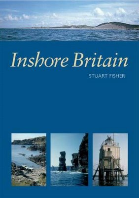
Inshore Britain arrived by post this morning. I was not disappointed. Published by Imray of Charts and Pilots fame, it is an A4 format and has 357 pages. On the back cover I was delighted to see a photo of a little known, but striking, rock arch on the Solway. Clearly Stuart has taken the time to paddle the coast and not gone from headland to headland as many circumnavigators have done to save time. It took him 15 years to complete his paddle round Britain. This is an author who has savoured his trips and his writing conveys his enjoyment and enthusiasm for exploring the coast by sea kayak.

The book is divided into 62 sections starting with west Cornwall and working clockwise round the coast. Each section consists of 4 to 8 pages and covers a distance varying from about 80 to 180km. The section of coast is outlined by very clear but large scale line maps (you will still need other more detailed maps or charts). There are very many of the authors own photographs. They include a number of really excellent A3 wide panoramas but most photographs are quite small, given the format of the book. There is a highlighted text box covering local information including tidal constants. Tidal flows are mentioned in the body of the text and as some sections are nearly 4,00o words long, it can take a moment or two to track them down.

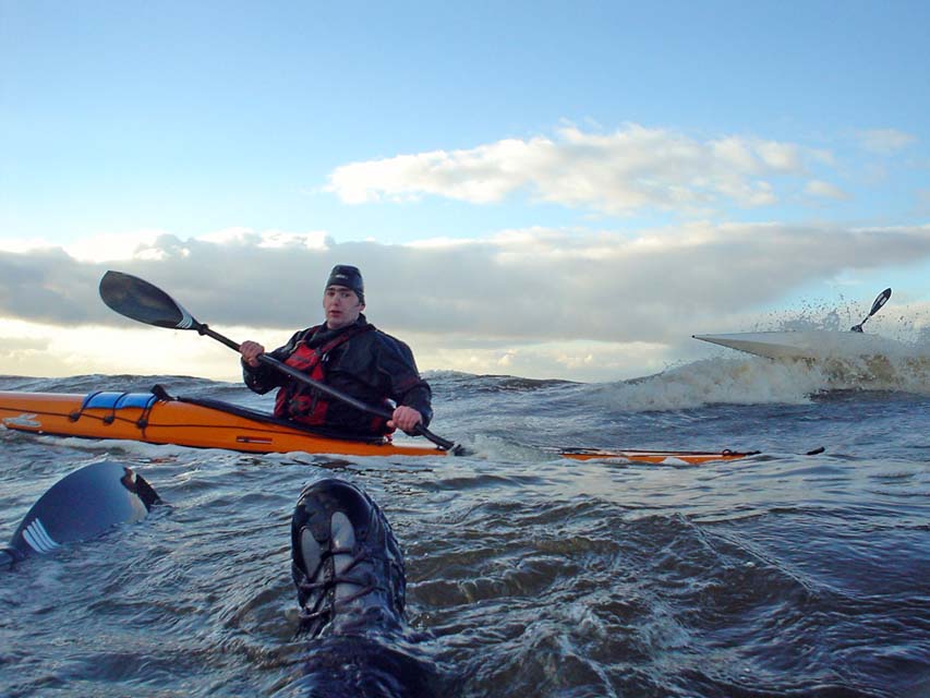
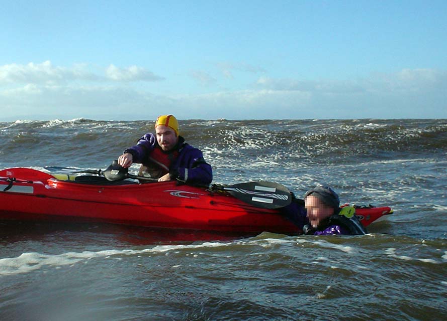
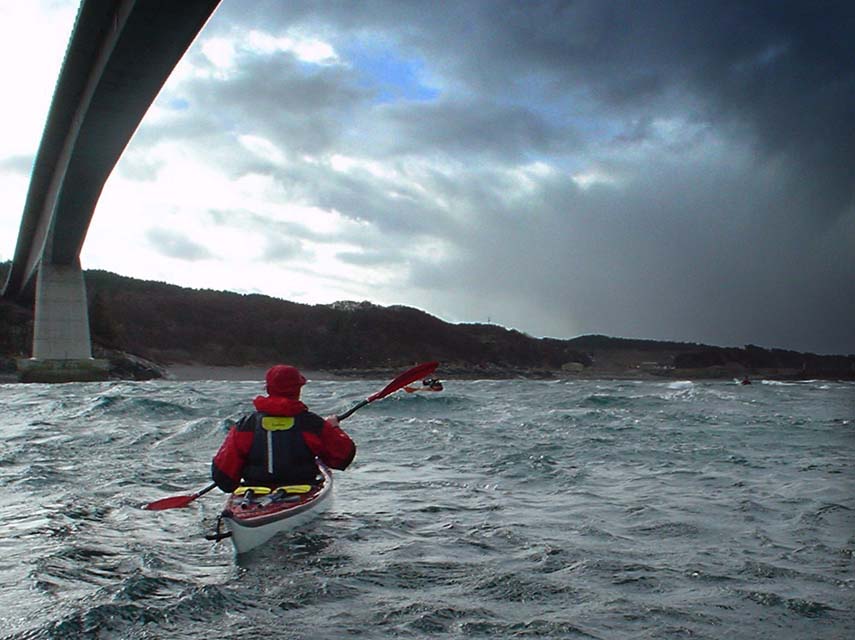
Taking the Solway section as an example, it covers 131 km in 6 pages. The line map covers the central part of two adjacent A4 pages and the text has been overlaid on the inland areas. There are 11 photographs that include close range shots of distinctive buildings and rock features but I also like the wide angle shots of distinctive hills and islands which give a good idea of the look of the coast from a kayak. The text is about 3,500 words. It is very well written and gives a detailed account of things to see not just from the kayak but covers points of interest a short distance inland as well. Stuart gives a good account of the weather conditions he met: "into Wigtown Bay where southerly winds rise with little warning and bring heavy seas". This is something I know of very well! However, for one person to have local knowledge of all the differing conditions of the whole coast of Britain would be expecting too much. He does not mention the strong gusty NW winds which come down off the Galloway hills and have caused many recreational boating fatalities over the last years. Nor does he mention the seasonal inshore lifeboat stationed at Mossyard as a result of these accidents (after Stuart had published this section in Canoeist) but he does detail the all year inshore lifeboat at Kirkcudbright. From my local knowledge of this section it is clear to me that Stuart has thouroughly paddled and researched the area. The guide would thus be invaluable to anyone new to the area who might otherwise miss a great deal. He has resisted the temptation to detail what is round every corner and there will still be the satisfaction of exploring and finding the unexpected.

A reviewer has to try and identify any weakness in a book. Well that would be difficult in this case. I have checked the Solway tidal data and it is accurate. Several of the caravan and campsites mentioned are no longer open to non resident visitors. The most kayak friendly campsite, Brighouse Bay, is called Pennymuir in the book, a name even the locals no longer use and a name which is not on the OS map. There are one or two typos including a page number on the contents page, so as usual, I would always use more than one source to check tidal data. A couple of others I showed the book to this evening thought there was too much text and the photos should have been bigger. Some of the older members of the sea kayaking club felt that his original magazine articles were a bit wordy. I disagree, I loved the few original articles I had read. Now they are gathered together in a reference book, I am looking forward to a number of long winter evenings engrossed, reading about new areas. Do note that the title is "Inshore Britain". It does not detail islands such as the Isle of Wight, Anglesey, Isle of Man, Arran, Mull, Skye or the Outer Hebrides.

This book is essential reference for any sea kayaker. It will allow you to get enough backround information to help plan a paddle in a new area (without buying all the local pilots) and also give you a wealth of background knowledge of the coast. Highly recommended.

PS A delightful touch is the use of postage stamps as small fillers throughout the book. These either have a nautical theme or have local relevance, e.g. a stamp of the Queen Mother's 90 birthday is situated near her summer residence on the map of the Caithness coast.