Wednesday, November 15, 2006

Sea Kayak by Gordon Brown


Pesda Press have announced a publication date of 7/12/2006 for a much awaited book. "Sea Kayak" is a modern guide to sea kayaking for intermediate to advanced sea kayakars. The author is Gordon Brown; authority, guru, maestro, mentor and all round good guy from Skye.

Two taster chapers have been posted on the Pesda website. Chapter 12 covers "Reading the water" while chapter 15 deals with "Big Swell". Both will have the sea kayaking community salivating with anticipation.

The opening photo of chapter 15 features Cailean on the crest of a wave. To quote from Gordon in chapter 15:

If you have a distant horizon the waves are less than one metre.
If your horizon is the crest of the wave immediately in front, the waves are over a metre.
Anything bigger than this is only talk for the party afterwards.


Some party Cailean!

Tuesday, November 14, 2006

"Over the sea to Skye"


The Skye Bridge gives the words of the old song new meaning. It spans the tidal narrows of Kyle Akin and in 1995 replaced the Skye ferry that ran between Kyle of Lochalsh and Kylakin. For the next 9 years it was the most expensive toll bridge in Europe. A return trip in a car cost about £12. Then in 2004 the Scottish Executive bought the bridge from the company that built it and the bridge is now toll free.

It was through Kyle Akin that a government warship made its way to destroy Eilean Donan castle in 1719. Four and a half centuries earlier, King Hakon of Norway led his longships through the same narows before his defeat by the Scots at the Battle of Largs in 1263. The kyle (narrow straight) was named after him.


The lighthouse stands on Eilean Ban. The author Gavin Maxwell spent the last year of his life here after his house, Camusfearna, was destroyed in a fire. It was situated at nearby Sandaig.


The tidal times, flow rates and even direction are very unpredictable and are affected by air pressure, rain fall and snow melt. The narrows run far faster than you can paddle and when wind is against tide can give challenging conditions.

Monday, November 13, 2006

Inshore Britain: first impression


Inshore Britain provides nearly all the information you need to plan your paddle round the coast of mainland Britain but it is much more. It is packed with details of history, geology, wild life and lots of other things to look out for on the way.

I seldom buy books unseen but I did so in this case because Stuart Fisher has already published a series of articles about his voyage round Britain in Canoeist magazine. Many years ago I found a dog eared copy of Canoeist magazine, issue 123, in a second hand bookshop. It contained Stuart's article on paddling the Solway coastline. It was one of the reasons I took up sea kayaking and it also inspired me to write about it. I have since published two articles about paddling the Solway coast in Paddles magazine.

Inshore Britain arrived by post this morning. I was not disappointed. Published by Imray of Charts and Pilots fame, it is an A4 format and has 357 pages. On the back cover I was delighted to see a photo of a little known, but striking, rock arch on the Solway. Clearly Stuart has taken the time to paddle the coast and not gone from headland to headland as many circumnavigators have done to save time. It took him 15 years to complete his paddle round Britain. This is an author who has savoured his trips and his writing conveys his enjoyment and enthusiasm for exploring the coast by sea kayak.

The book is divided into 62 sections starting with west Cornwall and working clockwise round the coast. Each section consists of 4 to 8 pages and covers a distance varying from about 80 to 180km. The section of coast is outlined by very clear but large scale line maps (you will still need other more detailed maps or charts). There are very many of the authors own photographs. They include a number of really excellent A3 wide panoramas but most photographs are quite small, given the format of the book. There is a highlighted text box covering local information including tidal constants. Tidal flows are mentioned in the body of the text and as some sections are nearly 4,00o words long, it can take a moment or two to track them down.

Taking the Solway section as an example, it covers 131 km in 6 pages. The line map covers the central part of two adjacent A4 pages and the text has been overlaid on the inland areas. There are 11 photographs that include close range shots of distinctive buildings and rock features but I also like the wide angle shots of distinctive hills and islands which give a good idea of the look of the coast from a kayak. The text is about 3,500 words. It is very well written and gives a detailed account of things to see not just from the kayak but covers points of interest a short distance inland as well. Stuart gives a good account of the weather conditions he met: "into Wigtown Bay where southerly winds rise with little warning and bring heavy seas". This is something I know of very well! However, for one person to have local knowledge of all the differing conditions of the whole coast of Britain would be expecting too much. He does not mention the strong gusty NW winds which come down off the Galloway hills and have caused many recreational boating fatalities over the last years. Nor does he mention the seasonal inshore lifeboat stationed at Mossyard as a result of these accidents (after Stuart had published this section in Canoeist) but he does detail the all year inshore lifeboat at Kirkcudbright. From my local knowledge of this section it is clear to me that Stuart has thouroughly paddled and researched the area. The guide would thus be invaluable to anyone new to the area who might otherwise miss a great deal. He has resisted the temptation to detail what is round every corner and there will still be the satisfaction of exploring and finding the unexpected.

A reviewer has to try and identify any weakness in a book. Well that would be difficult in this case. I have checked the Solway tidal data and it is accurate. Several of the caravan and campsites mentioned are no longer open to non resident visitors. The most kayak friendly campsite, Brighouse Bay, is called Pennymuir in the book, a name even the locals no longer use and a name which is not on the OS map. There are one or two typos including a page number on the contents page, so as usual, I would always use more than one source to check tidal data. A couple of others I showed the book to this evening thought there was too much text and the photos should have been bigger. Some of the older members of the sea kayaking club felt that his original magazine articles were a bit wordy. I disagree, I loved the few original articles I had read. Now they are gathered together in a reference book, I am looking forward to a number of long winter evenings engrossed, reading about new areas. Do note that the title is "Inshore Britain". It does not detail islands such as the Isle of Wight, Anglesey, Isle of Man, Arran, Mull, Skye or the Outer Hebrides.

This book is essential reference for any sea kayaker. It will allow you to get enough backround information to help plan a paddle in a new area (without buying all the local pilots) and also give you a wealth of background knowledge of the coast. Highly recommended.

PS A delightful touch is the use of postage stamps as small fillers throughout the book. These either have a nautical theme or have local relevance, e.g. a stamp of the Queen Mother's 90 birthday is situated near her summer residence on the map of the Caithness coast.

Sunday, November 12, 2006

Canna population grow again?


The rural idyll of Canna, which is one of the four "Small Isles" in the Inner Hebrides, is about to reverse a population decline. The National Trust for Scotland owns the island and is advertising for two new families to join the fifteen strong resident population. The Trust has received over 350 applications from all over the world!


Much of the island is surrounded by forbidding cliffs but there is a welcoming natural harbour at its SE corner and the interior of the island is surprisingly fertile and wooded. It has been inhabited for at least 7,000 years.


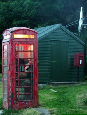
Being handy with tools is a necessary attribute for any incomer. The island's post office, telephone box and satellite telephone link are all powered by a genertator just along the road at the farm. It breaks down quite often.


Humans are not the only inhabitants who are returning to the isle. Manx shearwaters (pictured above off the north coast of Canna) have now returned to breed after the island's rats were exterminated in a similar exercise to that on Ailsa Craig.

Saturday, November 11, 2006

Unlocked island doors.


For centuries the unlocked door has been a feature of the hospitality of remote Highland and Island communities. Perhaps it has grown from an inate trust in human nature, or the need to take shelter from the frequent and sudden deteriorations in the weather. Some unkind commentators have said the houses had nothing worth stealing. Whatever, it is an enduring sign of an alternative approach to life in remote communities that has survived to the 21st century.


The lovely little island of Colonsay which lies in the Inner Hebrides between Jura and Mull, is studded with dazzling white shell sand beaches. On the machair behind the beaches lives the corncrake which is one the rarest birds in Britain. It shares the island with some wild goats, descended from those who survived the wrecking of a Spanish warship from the Armada. There are also 100 human residents who do not lock their doors.

Unfortunately the island has just suffered its first crime in 7 years. A visiting workman from Glasgow sold a crofter a bag of wood. After the crofter left the house, the workman returned and stole £60 from the money tin. (There is no bank on the island.) Fortunately the loss was discovered on a day when there was no ferry. The workman was detained by the island's joiner who is also a special constable. The thief was escorted to the ferry the next day and was arrested by police on the mainland.

A resident said "We are a close-knit community and we won't change our lifestyle."

Friday, November 10, 2006

Eilean Donan castle


A particular feature of Scottish sea kayaking is being able to paddle right up under the walls of many of the great castles which are dotted round the coastline. In the past, the sea was the main transport artery for the people living around Scotland. Eilean Donan castle is strategically placed at the head of Loch Alsh where it splits into Loch Long and Loch Duich. The mouth of Loch Alsh faces the island of Skye so it has two exits to the sea through the tidal races of Kyleakin and Kylerea. The castle dates from 1230 but was destroyed by an English warship in 1719 when it was being held by the Jacobites. They wished to see the return of a Stuart king to the throne of Great Britain. The Jacobite garrison thought they were safe, protected from large warships by the powerful tidal races but a local pilot, sympathetic to the government, guided the warship to the castle. Its cannon reduced the ancient walls to rubble and it was not restored to its present state until 1932.

Thursday, November 09, 2006

The bottlenose dolphins of Gigha and the Brownie of Cara


Recent talk of community buyouts takes us south again to the islands of Gigha and Cara. They lie at the south end of the Sound of Jura off the west coast of the Kintyre peninsula. There is a pod of bottlenosed dolphins which are frequently seen in these waters. One has a distinctive lateral curve to the dorsal fin and I have also seen them 60km further north in the Sound of Luing.

Although Gigha and Cara are not far from the mainland, the waters off their southern points can be very rough as they are exposed to westerly swells from the Atlantic.


The only house on Cara is haunted by a spirit called the "Brownie". It pays to be polite and doff a cap and greet the Brownie on arrival. If this is done, the Brownie can be a helpful spirit who can tidy up and make sure kayaks are above high water etc. However, if you upset him or if you are a Campbell, then he can be very mischievous and hide things in places you have already looked for them or even wake you with a hard slap.


If you sit round a fire, you would be advised to leave an empty space for the Brownie....


The three Paps of Jura lie across the Sound of Jura from Gigha. From further north, there is a more anatomically correct view which shows only two Paps.